World War II Pillbox, Parkgate
Introduction
The photograph on this page of World War II Pillbox, Parkgate by Jeff Buck as part of the Geograph project.
The Geograph project started in 2005 with the aim of publishing, organising and preserving representative images for every square kilometre of Great Britain, Ireland and the Isle of Man.

There are currently over 7.5m images from over 14,400 individuals and you can help contribute to the project by visiting https://www.geograph.org.uk
World War II Pillbox, Parkgate
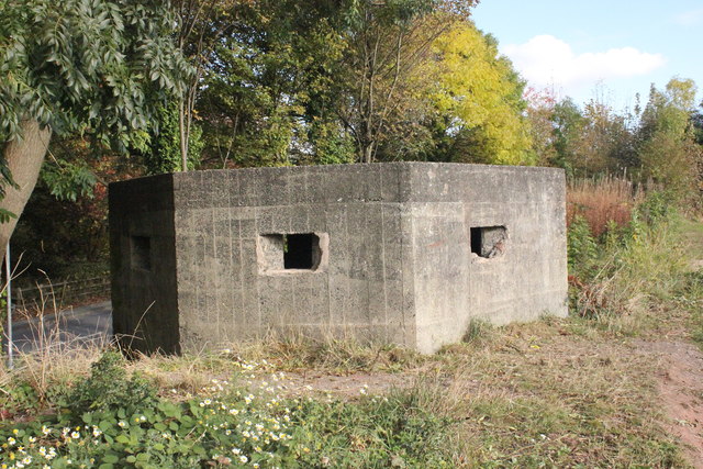
Image: © Jeff Buck Taken: 26 Oct 2016
This type 24 pillbox is situated on the south side of Parkgate Road between Parkgate and Neston next to the Wirral Way car park. The pillbox covered the road leading from the River Dee, where the West Kirby to Hooton section of the old Birkenhead Railway crosses. Source: pastscape.org
Images are licensed for reuse under creativecommons.org/licenses/by-sa/2.0
Image Location
Latitude
53.293193
Longitude
-3.076687