Bridgwater - animal feed mill and canal lock
Introduction
The photograph on this page of Bridgwater - animal feed mill and canal lock by Chris Allen as part of the Geograph project.
The Geograph project started in 2005 with the aim of publishing, organising and preserving representative images for every square kilometre of Great Britain, Ireland and the Isle of Man.

There are currently over 7.5m images from over 14,400 individuals and you can help contribute to the project by visiting https://www.geograph.org.uk
Bridgwater - animal feed mill and canal lock
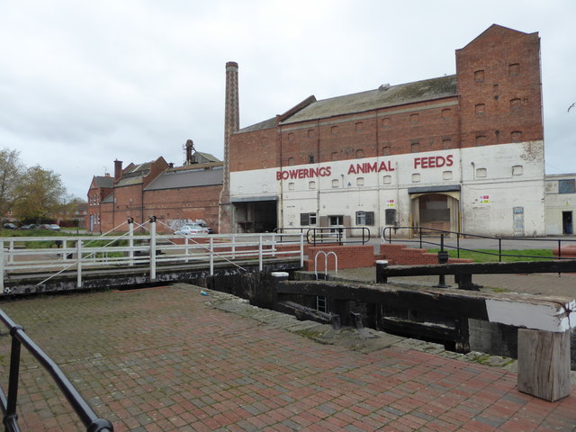
Image: © Chris Allen Taken: 14 Nov 2016
This is where the Bridgwater & Taunton Canal enters Bridgwater docks that are now shown on the map as a marina. Beyond is the still working Bowerings Animal Feeds mill with an elegant but disused chimney. This lock appears to be permanently open as the docks are no longer connected to the tidal River Parrett.
Images are licensed for reuse under creativecommons.org/licenses/by-sa/2.0
Image Location
Latitude
51.132603
Longitude
-3.008229