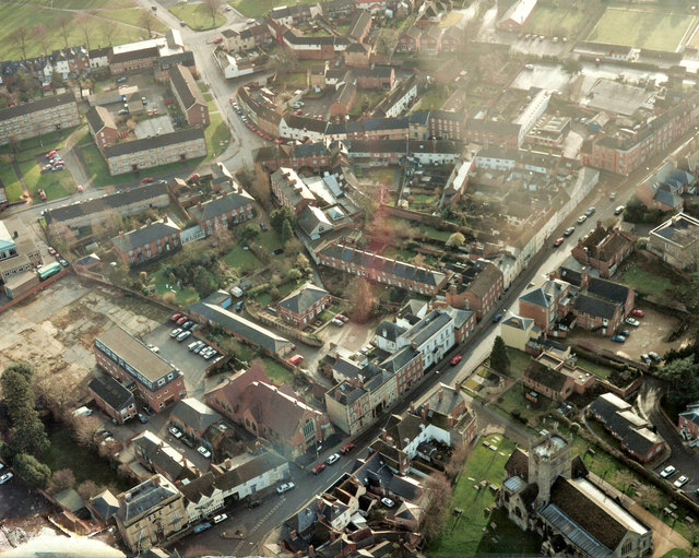
Aerial view of Long Street and Morris Lane, Devizes, Wiltshire c1991
Introduction
The photograph on this page of Aerial view of Long Street and Morris Lane, Devizes, Wiltshire c1991 by James Harrison as part of the Geograph project.
The Geograph project started in 2005 with the aim of publishing, organising and preserving representative images for every square kilometre of Great Britain, Ireland and the Isle of Man.
There are currently over 7.5m images from over 14,400 individuals and you can help contribute to the project by visiting https://www.geograph.org.uk

Image: © James Harrison Taken: Unknown
This aerial view of the Long Street/Morris Lane area of Devizes, Wiltshire, shows former buildings belong to Rendells, a long established firm of builders who ceased trading in the 1990s. Their offices (the long building on the north east corner of the red bricked church (St Andrew's Methodist Church), is today the HQ of the Wiltshire Wildlife Trust. As well as St Andrew's Methodist Church, the church seen in the lower righthand side of the picture is St John's, a Norman construction dating back to 1160. Devizes is well known for its street patterns, which resemble concentric circles radiating out from the original Norman castle. Morris Lane, seen in the centre of the photograph, is an old route from the castle and forms one of the radiating "spokes" that link the original banks and ditches that formed the outer defences of the castle and which today are reflected by the town's street pattern. The flats seen at the top of the photograph were built in the 1950s/60s and replaced a myriad of alleys, squares and yards that belonged to the houses of Sheep Street and the northern edge of Hare and Hound Street. Deemed "unfit for human habitation", the area was "improved" after the old buildings were cleared and new flats constructed in which residents were rehoused. Many said their community was never quite the same after the redevelopment.

