Beam River seen from New Road
Introduction
The photograph on this page of Beam River seen from New Road by Marathon as part of the Geograph project.
The Geograph project started in 2005 with the aim of publishing, organising and preserving representative images for every square kilometre of Great Britain, Ireland and the Isle of Man.

There are currently over 7.5m images from over 14,400 individuals and you can help contribute to the project by visiting https://www.geograph.org.uk
Beam River seen from New Road
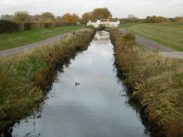
Image: © Marathon Taken: 16 Nov 2016
The Beam River is seen here looking upriver from New Road. The structure in the distance is for flood control. This is the southern entrance to Beam Valley Country Park. See http://www.thameschase.org.uk/visitor-centres/dagenham-and-romford/beam-valley-country-park and https://en.wikipedia.org/wiki/Beam_Valley_Country_Park for more information on the park. Above the confluence with the Ravensbourne, near Harrow Lodge Park, the Beam River is known as the River Rom. The Beam flows into the Thames at Dagenham - see https://en.wikipedia.org/wiki/River_Rom for more information on the Beam River.
Images are licensed for reuse under creativecommons.org/licenses/by-sa/2.0
Image Location
Latitude
51.528256
Longitude
0.165164