Gorof Nedd / Cored Nedd
Introduction
The photograph on this page of Gorof Nedd / Cored Nedd by Alan Richards as part of the Geograph project.
The Geograph project started in 2005 with the aim of publishing, organising and preserving representative images for every square kilometre of Great Britain, Ireland and the Isle of Man.

There are currently over 7.5m images from over 14,400 individuals and you can help contribute to the project by visiting https://www.geograph.org.uk
Gorof Nedd / Cored Nedd
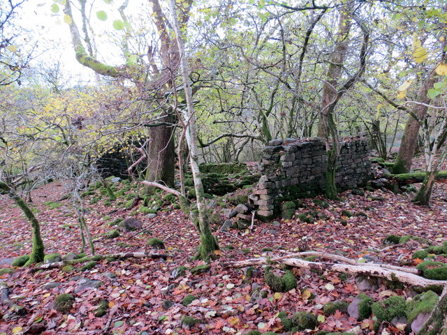
Image: © Alan Richards Taken: 16 Nov 2016
Afeilion anhedd-dy o'r enw Cored Nedd. Gorof Nedd oedd yr enw gwreiddiol The ruins of an abode known as Cored Nedd (trans. Nedd [river] weir/ fish trap). Its earlier name was Gorof Nedd (trans. wooded precipice by the Nedd river).
Images are licensed for reuse under creativecommons.org/licenses/by-sa/2.0
Image Location
Latitude
51.790485
Longitude
-3.577002