Site of Greenock Navy Buildings
Introduction
The photograph on this page of Site of Greenock Navy Buildings by Lairich Rig as part of the Geograph project.
The Geograph project started in 2005 with the aim of publishing, organising and preserving representative images for every square kilometre of Great Britain, Ireland and the Isle of Man.

There are currently over 7.5m images from over 14,400 individuals and you can help contribute to the project by visiting https://www.geograph.org.uk
Site of Greenock Navy Buildings
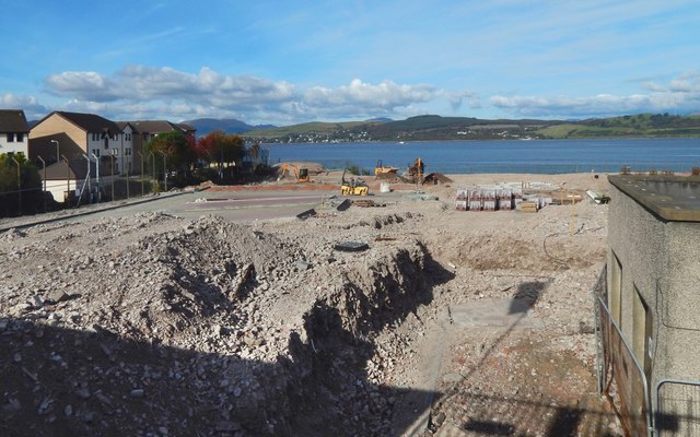
Image: © Lairich Rig Taken: 10 Oct 2016
Nearly 100 flats are to be built on the site. As the present picture shows, early stages of construction are underway; see also Image, taken on the same day. Compare views of the cleared area from about five months earlier: Image / Image / Image / Image / Image For distant views of the site before and after the demolition of the Navy Buildings, see Image / Image For closer views of the Navy Buildings that were demolished, see Image / Image / Image / Image
Images are licensed for reuse under creativecommons.org/licenses/by-sa/2.0
Image Location


Leaflet Map data © OpenStreetMap
Latitude
55.962598
Longitude
-4.79248