Drumry from the air
Introduction
The photograph on this page of Drumry from the air by Thomas Nugent as part of the Geograph project.
The Geograph project started in 2005 with the aim of publishing, organising and preserving representative images for every square kilometre of Great Britain, Ireland and the Isle of Man.

There are currently over 7.5m images from over 14,400 individuals and you can help contribute to the project by visiting https://www.geograph.org.uk
Drumry from the air
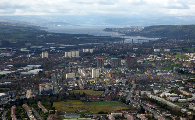
Image: © Thomas Nugent Taken: 7 Apr 2016
Queen Mary Avenue is in the foreground, Kilbowie Cemetery is in the left foreground. The Erskine Bridge, Firth of Clyde and the Cowal Hills can all be seen.
Images are licensed for reuse under creativecommons.org/licenses/by-sa/2.0
Image Location
Latitude
55.907548
Longitude
-4.393286