Christ Church pinnacles
Introduction
The photograph on this page of Christ Church pinnacles by Neil Owen as part of the Geograph project.
The Geograph project started in 2005 with the aim of publishing, organising and preserving representative images for every square kilometre of Great Britain, Ireland and the Isle of Man.

There are currently over 7.5m images from over 14,400 individuals and you can help contribute to the project by visiting https://www.geograph.org.uk
Christ Church pinnacles
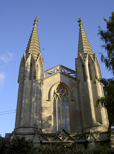
Image: © Neil Owen Taken: 7 Nov 2016
The need for a new church was pronounced by Archdeacon Daubeney, citing the nearest church was over four miles away. He ordered Christ Church to be founded in 1824, with its prominent architecture occupying a prime spot on Rode Hill. However, competition from St Lawrence and spiralling repair costs eventually forced its closure in 1995. It is now in private hands.
Images are licensed for reuse under creativecommons.org/licenses/by-sa/2.0
Image Location
Latitude
51.286153
Longitude
-2.279421