Railway east of Mistley station
Introduction
The photograph on this page of Railway east of Mistley station by Robin Webster as part of the Geograph project.
The Geograph project started in 2005 with the aim of publishing, organising and preserving representative images for every square kilometre of Great Britain, Ireland and the Isle of Man.

There are currently over 7.5m images from over 14,400 individuals and you can help contribute to the project by visiting https://www.geograph.org.uk
Railway east of Mistley station
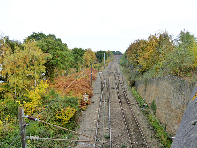
Image: © Robin Webster Taken: 30 Oct 2016
Two disused turnouts with their crossings removed and point blades fixed in position are below. The one on the right was for a siding, which a long time ago was connected to a sharply curved and inclined line to Mistley Quay passing under the main line and turning through 180 degrees on its way down. This feature was just beyond the far bridge. This connection was removed, leaving only a siding. It was replaced by a zig-zag route, latterly leaving the main line by the turnout on the left. It is interesting that the speed restriction sign for this route is still in place, after years of disuse. A two lever ground frame for the right-hand turnout is on the right, but not connected, although point rodding trails off to somewhere, almost certainly to the catch point for the siding. There is probably something similar hidden in the bracken for the left-hand connection.
Images are licensed for reuse under creativecommons.org/licenses/by-sa/2.0
Image Location
Latitude
51.943814
Longitude
1.083974