Church of England Institute, Marhamchurch
Introduction
The photograph on this page of Church of England Institute, Marhamchurch by Derek Harper as part of the Geograph project.
The Geograph project started in 2005 with the aim of publishing, organising and preserving representative images for every square kilometre of Great Britain, Ireland and the Isle of Man.

There are currently over 7.5m images from over 14,400 individuals and you can help contribute to the project by visiting https://www.geograph.org.uk
Church of England Institute, Marhamchurch
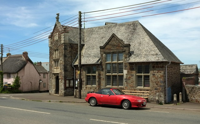
Image: © Derek Harper Taken: 31 May 2016
Also shown in Image Described at https://www.historicengland.org.uk/listing/the-list/list-entry/1141805 as "Arts and Crafts, free Tudor style", the building, with its "grand 2-storey gabled corner porch", is listed. The thatched cottage on the left is also listed https://www.historicengland.org.uk/listing/the-list/list-entry/1278402 .
Images are licensed for reuse under creativecommons.org/licenses/by-sa/2.0
Image Location
Latitude
50.805651
Longitude
-4.522094