The Crags Circular Path leaving a farm road
Introduction
The photograph on this page of The Crags Circular Path leaving a farm road by Lairich Rig as part of the Geograph project.
The Geograph project started in 2005 with the aim of publishing, organising and preserving representative images for every square kilometre of Great Britain, Ireland and the Isle of Man.

There are currently over 7.5m images from over 14,400 individuals and you can help contribute to the project by visiting https://www.geograph.org.uk
The Crags Circular Path leaving a farm road
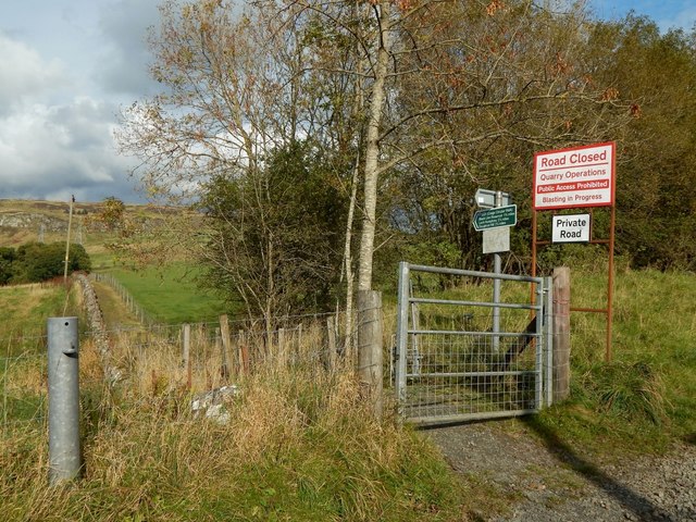
Image: © Lairich Rig Taken: 21 Oct 2016
The green sign replaces one shown in earlier pictures (Image and Image), which simply bore the text "The Crags Circular Path". The new sign reads as follows: "Path (Crags Circular Walk) Black Linn Reservoir 1¾ miles Loch Humphrey 2¼ miles Doughnot Hill 2½ miles" For a view along the path from just beyond the gate, see Image
Images are licensed for reuse under creativecommons.org/licenses/by-sa/2.0
Image Location
Latitude
55.94205
Longitude
-4.511203