The old, new High Light, North Shields
Introduction
The photograph on this page of The old, new High Light, North Shields by Chris Morgan as part of the Geograph project.
The Geograph project started in 2005 with the aim of publishing, organising and preserving representative images for every square kilometre of Great Britain, Ireland and the Isle of Man.

There are currently over 7.5m images from over 14,400 individuals and you can help contribute to the project by visiting https://www.geograph.org.uk
The old, new High Light, North Shields
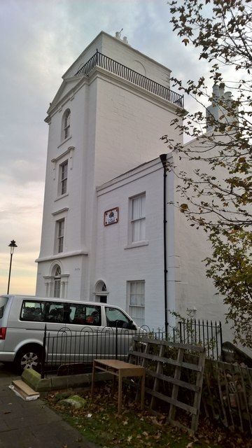
Image: © Chris Morgan Taken: 30 Oct 2016
Built in 1808 to replace earlier lights. This and the Low Light nearer the river and Fish Quay were necessary to guide sailors into the Tyne before the river was dredged and the piers built to shelter the harbour. See Wiki for more information on the history; https://en.wikipedia.org/wiki/High_and_Low_Lights_of_North_Shields No longer active and a nice house with a wonderful view. The two lights still assist vessels to take a daytime line of sight into the river.
Images are licensed for reuse under creativecommons.org/licenses/by-sa/2.0
Image Location
Latitude
55.008591
Longitude
-1.437868