Stanely Reservoir and Castle
Introduction
The photograph on this page of Stanely Reservoir and Castle by Thomas Nugent as part of the Geograph project.
The Geograph project started in 2005 with the aim of publishing, organising and preserving representative images for every square kilometre of Great Britain, Ireland and the Isle of Man.

There are currently over 7.5m images from over 14,400 individuals and you can help contribute to the project by visiting https://www.geograph.org.uk
Stanely Reservoir and Castle
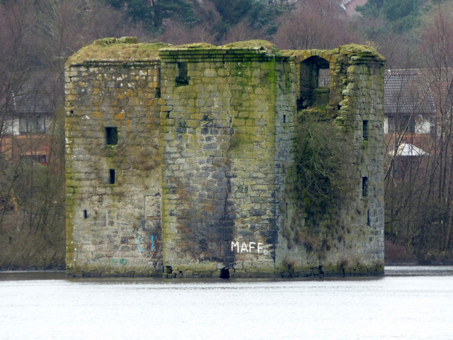
Image: © Thomas Nugent Taken: 29 Feb 2016
The ruined early 15th Century castle is at the west end of the reservoir and is surrounded by water which covers the ground floor.
Images are licensed for reuse under creativecommons.org/licenses/by-sa/2.0
Image Location
Latitude
55.823393
Longitude
-4.454053