Westbury-sub-Mendip village hall
Introduction
The photograph on this page of Westbury-sub-Mendip village hall by Neil Owen as part of the Geograph project.
The Geograph project started in 2005 with the aim of publishing, organising and preserving representative images for every square kilometre of Great Britain, Ireland and the Isle of Man.

There are currently over 7.5m images from over 14,400 individuals and you can help contribute to the project by visiting https://www.geograph.org.uk
Westbury-sub-Mendip village hall
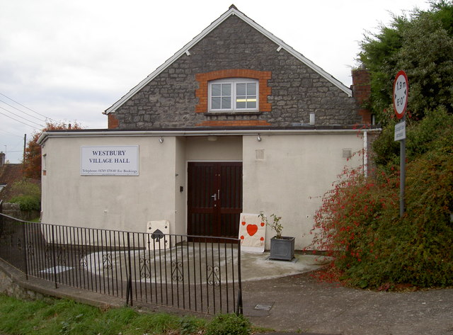
Image: © Neil Owen Taken: 27 Oct 2016
The villagers had hoped to be able to use the recently built schoolrooms as a public venue but were denied; they subsequently embarked on a strenuous fund-raising effort to secure a suitable community resource. The village hall was built by local builders the Dennis brothers in just three months. The cost of the land and the building was around £350 and these funds were raised by the villagers over a period of time. It was officially opened on Wednesday, 10th December 1913 by Mrs Graves-Knyfton of Uphill Manor. The local church bells rang in celebration. Perhaps there is a bridge afternoon in progress today. Or possibly the weekly poker tournament?
Images are licensed for reuse under creativecommons.org/licenses/by-sa/2.0
Image Location
Latitude
51.234753
Longitude
-2.71554