Plaque marking the site of the Long Well
Introduction
The photograph on this page of Plaque marking the site of the Long Well by Lairich Rig as part of the Geograph project.
The Geograph project started in 2005 with the aim of publishing, organising and preserving representative images for every square kilometre of Great Britain, Ireland and the Isle of Man.

There are currently over 7.5m images from over 14,400 individuals and you can help contribute to the project by visiting https://www.geograph.org.uk
Plaque marking the site of the Long Well
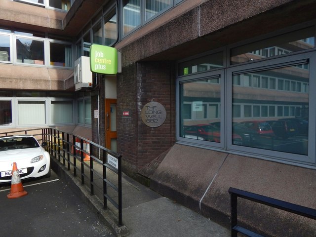
Image: © Lairich Rig Taken: 3 Oct 2016
The plaque is number 17 on the Central Greenock Statues Trail. It is in an out-of-the-way spot, on an office building that can be accessed by a lane leading off Cathcart Street. The lane used to be (and perhaps still is) called Duff Street, although the office building shown here now blocks off its northern end. Duff Street, named after one of the town's Bailies, replaced the earlier Longwell Close, a very old thoroughfare, which was eventually condemned and demolished. The site of the Long Well on Duff Street used to be (in the early years of the twentieth century) marked by a flagstone, which, like the plaque in the present image, bore the inscription "The Long Well, 1682". George Williamson, on pages 30–32 of his "Old Greenock ..." (1886), quotes an old charter of 1683, which mentions a certain James Johnstoune and "the well builded be him and uthers his neighbours upon their owne charges". Williamson notes that "it was evidently in connection with James Johnstone's well that the name Longwell was given to the Closs or Lane leading from Cathcart Street to Shaw Street, from whence by a slight deflection access is gained to the Harbour, formerly the sea shore". He goes on to record that "some old residenters assert that the 'Long Well' is fifty, others sixty, feet deep. This we can well credit. It is satisfactory to state that in the course of the operations of the Improvement Trust in removing the old houses in the Closs for the formation of what is now known as Duff Street a deep well has been discovered, which fully answers the description above given." Williamson goes on to give an account of its discovery and its dimensions. As for the flagstone mentioned earlier, it was set in the ground, about halfway along Duff Street (and therefore near where the modern plaque is located); I presume that the flagstone was removed in connection with later construction work on that street (either in connection with this office block, or at an earlier time). The plaque in the picture is clearly modern.
Images are licensed for reuse under creativecommons.org/licenses/by-sa/2.0
Image Location
Latitude
55.94736
Longitude
-4.7547