Path leaving the cycle route above Gibshill
Introduction
The photograph on this page of Path leaving the cycle route above Gibshill by Lairich Rig as part of the Geograph project.
The Geograph project started in 2005 with the aim of publishing, organising and preserving representative images for every square kilometre of Great Britain, Ireland and the Isle of Man.

There are currently over 7.5m images from over 14,400 individuals and you can help contribute to the project by visiting https://www.geograph.org.uk
Path leaving the cycle route above Gibshill
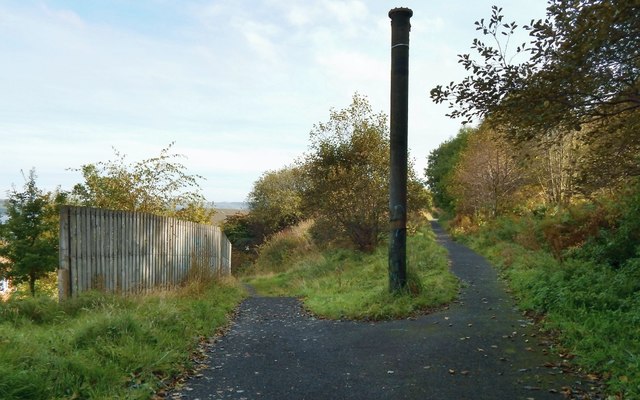
Image: © Lairich Rig Taken: 3 Oct 2016
The cycle route here (shown on the right) is at the upper margin of the Image housing estate; the short path shown heading downhill on the left leads there. For a view from its lower end, see Image The junction shown in the present picture, and marked by what looks like an industrial relic, is shown from the other side in Image The upright pipe may be intended as artwork, given that there are industrial-themed sculptures nearby on this cycle path: Image / Image
Images are licensed for reuse under creativecommons.org/licenses/by-sa/2.0
Image Location
Latitude
55.934312
Longitude
-4.714861