Bog Cottages
Introduction
The photograph on this page of Bog Cottages by Matthew Hatton as part of the Geograph project.
The Geograph project started in 2005 with the aim of publishing, organising and preserving representative images for every square kilometre of Great Britain, Ireland and the Isle of Man.

There are currently over 7.5m images from over 14,400 individuals and you can help contribute to the project by visiting https://www.geograph.org.uk
Bog Cottages
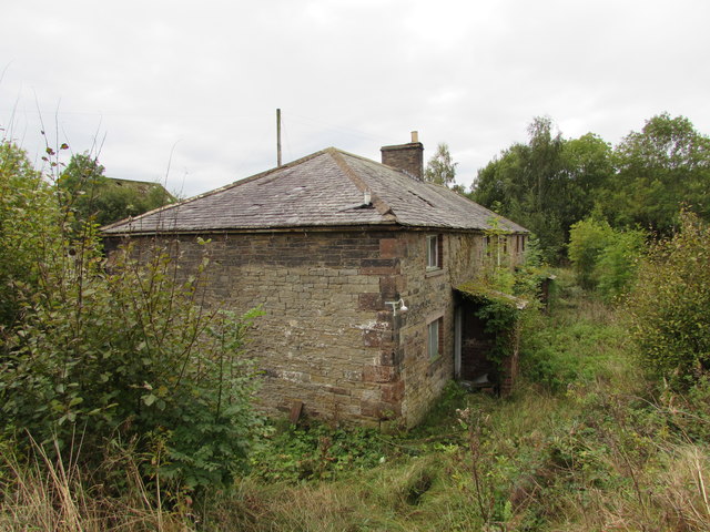
Image: © Matthew Hatton Taken: 7 Oct 2016
Now derelict, this row of cottages was built c.1883 to house workers for the nearby coke ovens and gas works. They are in rapid decline.
Images are licensed for reuse under creativecommons.org/licenses/by-sa/2.0
Image Location
Latitude
54.932772
Longitude
-2.679778