Estuarial trackway at Chalkwell
Introduction
The photograph on this page of Estuarial trackway at Chalkwell by David Kemp as part of the Geograph project.
The Geograph project started in 2005 with the aim of publishing, organising and preserving representative images for every square kilometre of Great Britain, Ireland and the Isle of Man.

There are currently over 7.5m images from over 14,400 individuals and you can help contribute to the project by visiting https://www.geograph.org.uk
Estuarial trackway at Chalkwell
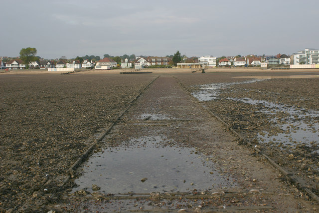
Image: © David Kemp Taken: 25 Oct 2016
This trackway runs from the shoreline for a few hundred metres into the Thames estuary towards Leigh Creek, crossing the pebbly mudflats that are exposed at low tide as it does so. En route it passes the Crow Stone near to which this shot was taken. The houses are situated on Chalkwell Esplanade.
Images are licensed for reuse under creativecommons.org/licenses/by-sa/2.0
Image Location
Latitude
51.536101
Longitude
0.678039