New footbridge, Knock River, Belfast (October 2016)
Introduction
The photograph on this page of New footbridge, Knock River, Belfast (October 2016) by Albert Bridge as part of the Geograph project.
The Geograph project started in 2005 with the aim of publishing, organising and preserving representative images for every square kilometre of Great Britain, Ireland and the Isle of Man.

There are currently over 7.5m images from over 14,400 individuals and you can help contribute to the project by visiting https://www.geograph.org.uk
New footbridge, Knock River, Belfast (October 2016)
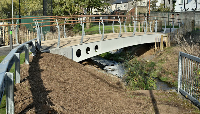
Image: © Albert Bridge Taken: 24 Oct 2016
The Connswater Greenway scheme includes several new footbridges across the Knock River (Conn’s Water on the Google map). This one is between Woodcot Avenue and The Hollow/Abetta Parade. Image shows the area during work but before construction of the bridge (of standard Greenway design) had started. Image shows the bridge after it had been named.
Images are licensed for reuse under creativecommons.org/licenses/by-sa/2.0
Image Location
Latitude
54.590947
Longitude
-5.888776