OS Flush Bracket - Monkhall
Introduction
The photograph on this page of OS Flush Bracket - Monkhall by Richard Law as part of the Geograph project.
The Geograph project started in 2005 with the aim of publishing, organising and preserving representative images for every square kilometre of Great Britain, Ireland and the Isle of Man.

There are currently over 7.5m images from over 14,400 individuals and you can help contribute to the project by visiting https://www.geograph.org.uk
OS Flush Bracket - Monkhall
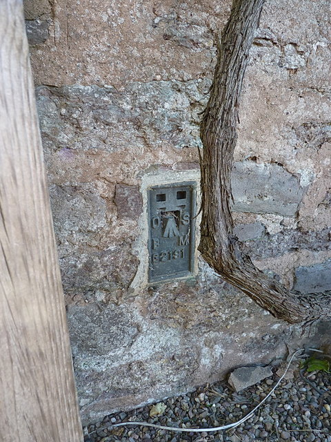
Image: © Richard Law Taken: 17 Sep 2016
OS Flush Bracket G2191 on a house just east of the junction to Momkhall and Kitesnest farms; originally levelled in 1952 at 140.893m above Ordnance Datum Newlyn.
Images are licensed for reuse under creativecommons.org/licenses/by-sa/2.0
Image Location
Latitude
52.5382
Longitude
-2.56651