Southbourne: the end of Hengistbury Road
Introduction
The photograph on this page of Southbourne: the end of Hengistbury Road by Chris Downer as part of the Geograph project.
The Geograph project started in 2005 with the aim of publishing, organising and preserving representative images for every square kilometre of Great Britain, Ireland and the Isle of Man.

There are currently over 7.5m images from over 14,400 individuals and you can help contribute to the project by visiting https://www.geograph.org.uk
Southbourne: the end of Hengistbury Road
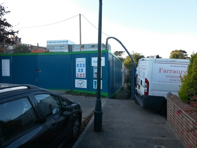
Image: © Chris Downer Taken: 22 Oct 2016
The dead end, here, of Hengistbury Road continues as a driveway for St. Peter's School, and also as public footpath number I14, directly ahead, leading to Sunnylands Avenue. The school is undergoing major building works, with considerable expansion, and as such there is a lot of temporary fencing here as the works compound is accessed from this point. See Image for the next view on the footpath ahead, with links to further photos along the route, and continuing paths heading to Southlands Avenue and Belle Vue Road.
Images are licensed for reuse under creativecommons.org/licenses/by-sa/2.0
Image Location
Latitude
50.723295
Longitude
-1.790281