Gordonstoun Doocot
Introduction
The photograph on this page of Gordonstoun Doocot by Anne Burgess as part of the Geograph project.
The Geograph project started in 2005 with the aim of publishing, organising and preserving representative images for every square kilometre of Great Britain, Ireland and the Isle of Man.

There are currently over 7.5m images from over 14,400 individuals and you can help contribute to the project by visiting https://www.geograph.org.uk
Gordonstoun Doocot
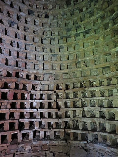
Image: © Anne Burgess Taken: 18 Oct 2016
Tiers of pigeon holes inside the beehive doocot at Gordonstoun. See https://canmore.org.uk/site/16113/gordonstoun-house-round-square-dovecot for details.
Images are licensed for reuse under creativecommons.org/licenses/by-sa/2.0
Image Location
Latitude
57.703
Longitude
-3.372032