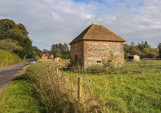
WWII Hampshire - former defended building: Fullerton, Wherwell (1)
Introduction
The photograph on this page of WWII Hampshire - former defended building: Fullerton, Wherwell (1) by Mike Searle as part of the Geograph project.
The Geograph project started in 2005 with the aim of publishing, organising and preserving representative images for every square kilometre of Great Britain, Ireland and the Isle of Man.
There are currently over 7.5m images from over 14,400 individuals and you can help contribute to the project by visiting https://www.geograph.org.uk

Image: © Mike Searle Taken: 17 Oct 2016
- Pillbox DoB ID: e09865 This humble little building of brick with flint bands is described by Historic England as a Grade II listed late C18 fodder store. What is not so well known is that in 1940 the building was rather cleverly adapted inside to conceal a pillbox. The inner walls were strengthened and their thickness increased to about 18 ins to accommodate on each of three sides, a pair of stepped loopholed embrasures. At a stroke the building's peacetime role changed to one more suited to a nation at war - a defended building, becoming part of the Salisbury East Stopline chain of defences created in 1940. These ran from Totton near Southampton to Basingstoke, via Romsey and the Test Valley. Situated close to Fullerton Mill, the River Test, the former Andover to Redbridge railway, and the main road from Andover to Stockbridge, the building was obviously chosen for its proximity to these locations. There is a particularly good view across the open field to the east, as well as to the north and south through the loopholed embrasures that are still the most visible evidence today of the building's wartime role. Image

