Townsend: onto footpath K47 from Throop Road
Introduction
The photograph on this page of Townsend: onto footpath K47 from Throop Road by Chris Downer as part of the Geograph project.
The Geograph project started in 2005 with the aim of publishing, organising and preserving representative images for every square kilometre of Great Britain, Ireland and the Isle of Man.

There are currently over 7.5m images from over 14,400 individuals and you can help contribute to the project by visiting https://www.geograph.org.uk
Townsend: onto footpath K47 from Throop Road
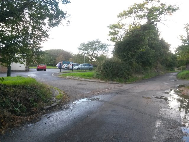
Image: © Chris Downer Taken: 16 Oct 2016
A public right of way, footpath K47, heads from Ibbertson Road to cut across the broad triangular grass area and meet Throop Road here. The course of the right of way appears to be mapped dead-straight, undefined across the grass to go through the car park directly ahead - see Image for a view illustrating this. However, the only available route is to come along the paved path onto the open space, and then veer off left alongside the car park railings. See Image for the view towards us from the path ahead, with links to further photos on the route.
Images are licensed for reuse under creativecommons.org/licenses/by-sa/2.0
Image Location
Latitude
50.751597
Longitude
-1.830129