Field next to the Andyke
Introduction
The photograph on this page of Field next to the Andyke by Nigel Mykura as part of the Geograph project.
The Geograph project started in 2005 with the aim of publishing, organising and preserving representative images for every square kilometre of Great Britain, Ireland and the Isle of Man.

There are currently over 7.5m images from over 14,400 individuals and you can help contribute to the project by visiting https://www.geograph.org.uk
Field next to the Andyke
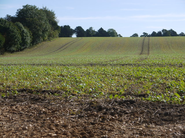
Image: © Nigel Mykura Taken: 23 Sep 2016
The Andyke, marked by the line of trees across the top of this field, is a large ditch and dyke ancient monument which may be the main defensive feature of what was once an iron age promontory fort, although the site has never been fully archaeologically studied. The A303 which runs behind the trees on the left, breaches the northern end of this 530 m long earthwork. The field in this photo is planted with stubble swede.
Images are licensed for reuse under creativecommons.org/licenses/by-sa/2.0
Image Location
Latitude
51.181332
Longitude
-1.39392