Ballintoy Parish Church
Introduction
The photograph on this page of Ballintoy Parish Church by Chris Morgan as part of the Geograph project.
The Geograph project started in 2005 with the aim of publishing, organising and preserving representative images for every square kilometre of Great Britain, Ireland and the Isle of Man.

There are currently over 7.5m images from over 14,400 individuals and you can help contribute to the project by visiting https://www.geograph.org.uk
Ballintoy Parish Church
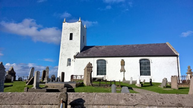
Image: © Chris Morgan Taken: 13 Oct 2016
This church was built in 1813 and replaced an earlier structure. Some distance from the modern village it is immediately above the picturesque harbour. Views from the cliffs are spectacular.
Images are licensed for reuse under creativecommons.org/licenses/by-sa/2.0
Image Location
Latitude
55.240153
Longitude
-6.366907