Lledfair Tollhouse, Machynlleth
Introduction
The photograph on this page of Lledfair Tollhouse, Machynlleth by Jaggery as part of the Geograph project.
The Geograph project started in 2005 with the aim of publishing, organising and preserving representative images for every square kilometre of Great Britain, Ireland and the Isle of Man.

There are currently over 7.5m images from over 14,400 individuals and you can help contribute to the project by visiting https://www.geograph.org.uk
Lledfair Tollhouse, Machynlleth
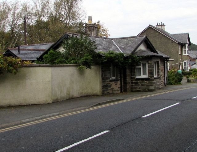
Image: © Jaggery Taken: 8 Oct 2016
Now a private residence, the former tollhouse is alongside what is now the A487. Various tolls for passing through the town by road were formerly levied by the Lord of the Manor and collected at this and several other tollhouses in Machynlleth. The Coflein website records that Machynlleth's turnpike gates and the need for the toll houses disappeared on May 12th 1882, when a local Highway Board became responsible for road maintenance and improvement. On March 28th 1885, a sum of £100 was collected by subscription by the townsfolk to be paid to the Lord of the Manor to mark the end of toll collection.
Images are licensed for reuse under creativecommons.org/licenses/by-sa/2.0
Image Location
Latitude
52.587749
Longitude
-3.855396