Brunswick Place - Western Side
Introduction
The photograph on this page of Brunswick Place - Western Side by Simon Carey as part of the Geograph project.
The Geograph project started in 2005 with the aim of publishing, organising and preserving representative images for every square kilometre of Great Britain, Ireland and the Isle of Man.

There are currently over 7.5m images from over 14,400 individuals and you can help contribute to the project by visiting https://www.geograph.org.uk
Brunswick Place - Western Side
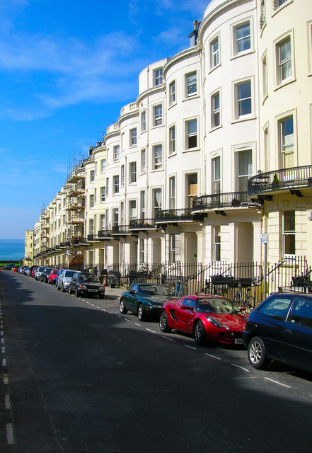
Image: © Simon Carey Taken: 3 Aug 2007
Brunswick Place lies between Western Road and Lansdowne Road and was developed about 20 years after the original Brunswick Town estate south of Western Road. The original town houses have long been subdivided into flats and at one time had sunk to being a poor area of time lacking modern utilities though today they retain a certain 'seen better days' look.
Images are licensed for reuse under creativecommons.org/licenses/by-sa/2.0
Image Location


Leaflet Map data © OpenStreetMap
Latitude
50.826936
Longitude
-0.158402