Old quarry
Introduction
The photograph on this page of Old quarry by Jonathan Wilkins as part of the Geograph project.
The Geograph project started in 2005 with the aim of publishing, organising and preserving representative images for every square kilometre of Great Britain, Ireland and the Isle of Man.

There are currently over 7.5m images from over 14,400 individuals and you can help contribute to the project by visiting https://www.geograph.org.uk
Old quarry
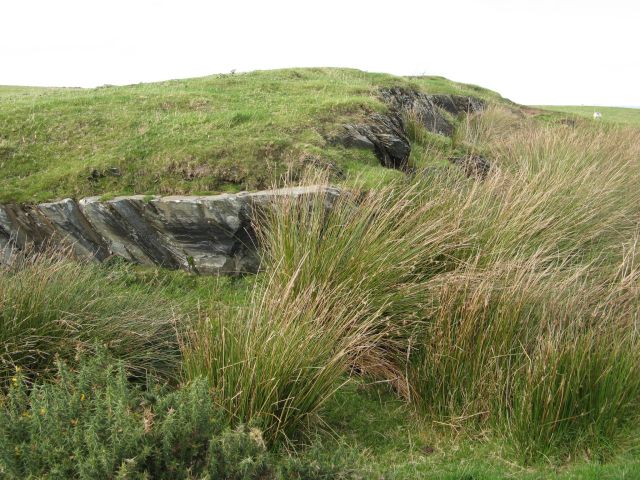
Image: © Jonathan Wilkins Taken: 6 Oct 2016
A small quarry producing a rough slate which would have been used for field walls and similar low-specification work. Mudstones and sandstones of Silurian age in the district all have a cleavage impressed as a consequence of low-grade metamorphism during the Caledonian period. The cleavage is inclined at around 45 degrees, but the bedding direction is obscure.
Images are licensed for reuse under creativecommons.org/licenses/by-sa/2.0
Image Location
Latitude
53.030998
Longitude
-3.729715