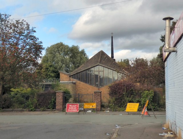
St Barnabas, Openshaw
Introduction
The photograph on this page of St Barnabas, Openshaw by Gerald England as part of the Geograph project.
The Geograph project started in 2005 with the aim of publishing, organising and preserving representative images for every square kilometre of Great Britain, Ireland and the Isle of Man.
There are currently over 7.5m images from over 14,400 individuals and you can help contribute to the project by visiting https://www.geograph.org.uk

Image: © Gerald England Taken: 28 Sep 2016
The original church of St Barnabas in Openshaw dated from 1837. The present church was built in 1961 to replace the original structure which had to be demolished. Constructed of brick, the church has a rectangular nave with short transepts beneath a hipped gull-wing roof. It closed in 2014 when the congregation joined with the Church of the Resurrection http://www.resurrectionstbarnabas.org.uk/about-us/history/ elsewhere in the parish. The burial ground was conveyed to Manchester City Council in 1981. The closed churchyard is now maintained by the local authority as a public open space and some 19th and early 20th century headstones remain in situ.

