3 - 4 Rose Hill
Introduction
The photograph on this page of 3 - 4 Rose Hill by Ian Capper as part of the Geograph project.
The Geograph project started in 2005 with the aim of publishing, organising and preserving representative images for every square kilometre of Great Britain, Ireland and the Isle of Man.

There are currently over 7.5m images from over 14,400 individuals and you can help contribute to the project by visiting https://www.geograph.org.uk
3 - 4 Rose Hill
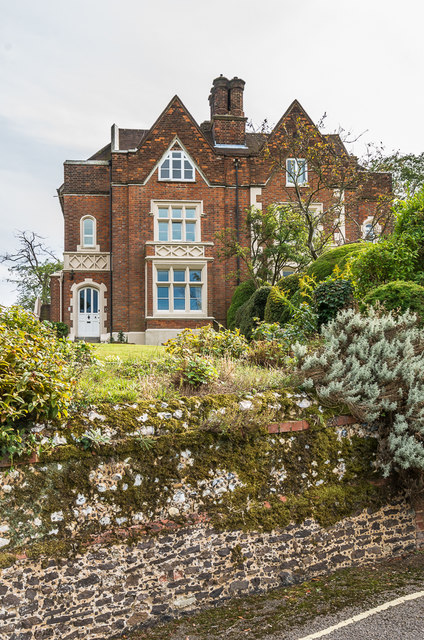
Image: © Ian Capper Taken: 24 Sep 2016
Mid 19th Century semi-detached villas in Rose Hill. Grade II listed - see https://www.historicengland.org.uk/listing/the-list/list-entry/1229457. The flint wall in front, which features galleting in both the main section and the sandstone rubble base, are separately grade II listed - see https://www.historicengland.org.uk/listing/the-list/list-entry/1229458.
Images are licensed for reuse under creativecommons.org/licenses/by-sa/2.0
Image Location
Latitude
51.229292
Longitude
-0.33119