
Radnage Church of England Primary School
Introduction
The photograph on this page of Radnage Church of England Primary School by David Hillas as part of the Geograph project.
The Geograph project started in 2005 with the aim of publishing, organising and preserving representative images for every square kilometre of Great Britain, Ireland and the Isle of Man.

There are currently over 7.5m images from over 14,400 individuals and you can help contribute to the project by visiting https://www.geograph.org.uk
Radnage Church of England Primary School
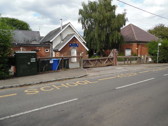
Image: © David Hillas Taken: 30 Jul 2016
Situated in City Road HP14 4DW, this school takes local children from Reception Class to Year 6. To the left of the photo can be seen a BT fibre-optic cabinet box ,whilst towards the right is a bus stop. At one time, Thames Valley bus route 40 then Wycombe Bus route 340 served Radnage, but these routes were withdrawn somewhile ago, hence no timetables are now shown on the bus stop.
Images are licensed for reuse under creativecommons.org/licenses/by-sa/2.0
Image Location

Latitude
51.663679
Longitude
-0.864548