Former Connaught Barracks, Dover Road
Introduction
The photograph on this page of Former Connaught Barracks, Dover Road by John Baker as part of the Geograph project.
The Geograph project started in 2005 with the aim of publishing, organising and preserving representative images for every square kilometre of Great Britain, Ireland and the Isle of Man.

There are currently over 7.5m images from over 14,400 individuals and you can help contribute to the project by visiting https://www.geograph.org.uk
Former Connaught Barracks, Dover Road
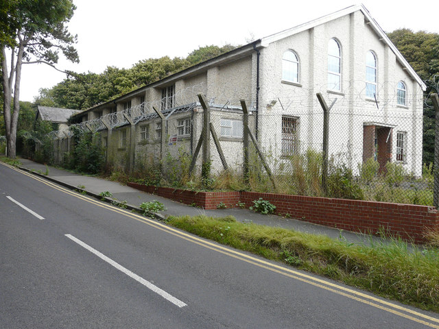
Image: © John Baker Taken: 9 Sep 2016
This is Building 15 and is due to be demolished but the smaller building beyond it (Building 14) is to be retained. Planning permission has been granted by Dover District Council under application number DOV/16/00618 for the “demolition of all buildings excluding Building 14”. Planning permission has also been granted by Dover District Council under application number DOV/16/00441 for a “change of use of building 14 to bat roost”. The location was described as Connaught Barracks (Main Site), Dover Road, Guston.
Images are licensed for reuse under creativecommons.org/licenses/by-sa/2.0
Image Location


Leaflet Map data © OpenStreetMap
Latitude
51.135626
Longitude
1.318728