Southbourne: Twynham Road crosses Foxholes Road
Introduction
The photograph on this page of Southbourne: Twynham Road crosses Foxholes Road by Chris Downer as part of the Geograph project.
The Geograph project started in 2005 with the aim of publishing, organising and preserving representative images for every square kilometre of Great Britain, Ireland and the Isle of Man.

There are currently over 7.5m images from over 14,400 individuals and you can help contribute to the project by visiting https://www.geograph.org.uk
Southbourne: Twynham Road crosses Foxholes Road
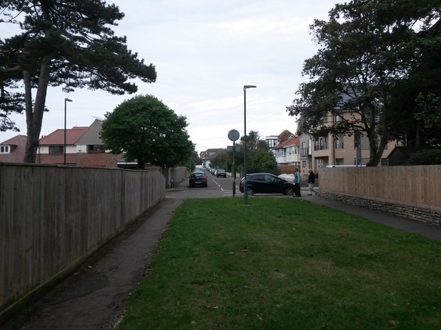
Image: © Chris Downer Taken: 24 Sep 2016
There are three segments to Twynham Road - the short section further behind us, which is cut off at this end; the middle section, here, which is infilled with grass; and the main lengthy section ahead of us. The middle section is designated as a public right of way - footpath I15 - specifically this southern pavement by the look of large-scale maps. See Image for the view towards us from across the road, and Image for the next view on the path behind us, and links to further pictures along the public footpath.
Images are licensed for reuse under creativecommons.org/licenses/by-sa/2.0
Image Location
Latitude
50.722945
Longitude
-1.795666