Watery tump
Introduction
The photograph on this page of Watery tump by Neil Owen as part of the Geograph project.
The Geograph project started in 2005 with the aim of publishing, organising and preserving representative images for every square kilometre of Great Britain, Ireland and the Isle of Man.

There are currently over 7.5m images from over 14,400 individuals and you can help contribute to the project by visiting https://www.geograph.org.uk
Watery tump
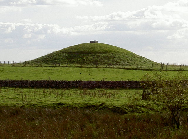
Image: © Neil Owen Taken: 23 Sep 2016
There are plenty of tumuli on the Mendips - indeed, there are a few in close proximity - but this one has a cap on the top. Of course, it's a small reservoir, but it's also shaped and grassed over rather like the old barrows. No coincidence?
Images are licensed for reuse under creativecommons.org/licenses/by-sa/2.0
Image Location


Leaflet Map data © OpenStreetMap
Latitude
51.252878
Longitude
-2.70708