Landscaped area at West Bridgend
Introduction
The photograph on this page of Landscaped area at West Bridgend by Lairich Rig as part of the Geograph project.
The Geograph project started in 2005 with the aim of publishing, organising and preserving representative images for every square kilometre of Great Britain, Ireland and the Isle of Man.

There are currently over 7.5m images from over 14,400 individuals and you can help contribute to the project by visiting https://www.geograph.org.uk
Landscaped area at West Bridgend
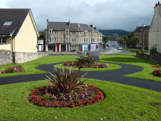
Image: © Lairich Rig Taken: 2 Sep 2016
Receding from view on the right is Bridge Street, crossing the River Leven by means of Image The area in the foreground has been free of buildings since before the Second World War, and its present layout of paths dates back at least 50 years. The road on the near side of the bridge is called West Bridgend, a name that also describes this area. In the background, beyond the bridge, the Long Crags are shrouded in low cloud.
Images are licensed for reuse under creativecommons.org/licenses/by-sa/2.0
Image Location
Latitude
55.944003
Longitude
-4.577636