Invergordon
Introduction
The photograph on this page of Invergordon by David Dixon as part of the Geograph project.
The Geograph project started in 2005 with the aim of publishing, organising and preserving representative images for every square kilometre of Great Britain, Ireland and the Isle of Man.

There are currently over 7.5m images from over 14,400 individuals and you can help contribute to the project by visiting https://www.geograph.org.uk
Invergordon
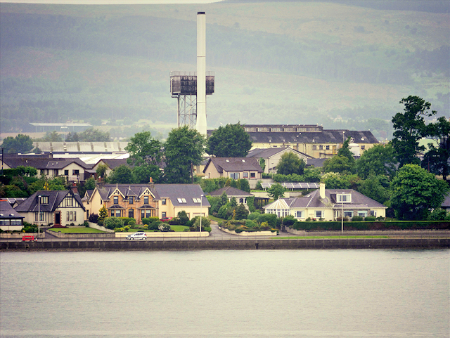
Image: © David Dixon Taken: 9 Jul 2016
View towards the shore road between Invergordon and Saltburn. Notable features inland are the tall distillery chimney and the water tower (NH 7129 6992).
Images are licensed for reuse under creativecommons.org/licenses/by-sa/2.0
Image Location
Latitude
57.693188
Longitude
-4.164234