Bell Lane
Introduction
The photograph on this page of Bell Lane by Ian Capper as part of the Geograph project.
The Geograph project started in 2005 with the aim of publishing, organising and preserving representative images for every square kilometre of Great Britain, Ireland and the Isle of Man.

There are currently over 7.5m images from over 14,400 individuals and you can help contribute to the project by visiting https://www.geograph.org.uk
Bell Lane
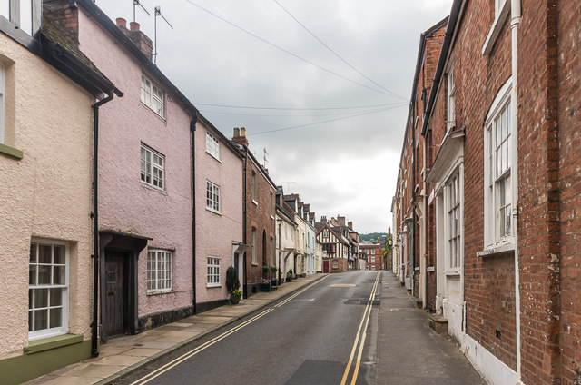
Image: © Ian Capper Taken: 12 Jul 2015
Road linking Mill Street and Broad Street, named after an inn, The Bell, that once stood at its junction with Raven Lane. On the left is nos 2-3, dating from the 18th Century and grade II listed - see https://www.historicengland.org.uk/listing/the-list/list-entry/1219083.
Images are licensed for reuse under creativecommons.org/licenses/by-sa/2.0
Image Location
Latitude
52.366114
Longitude
-2.719526