Canal Road, Worksop, Notts.
Introduction
The photograph on this page of Canal Road, Worksop, Notts. by David Hallam-Jones as part of the Geograph project.
The Geograph project started in 2005 with the aim of publishing, organising and preserving representative images for every square kilometre of Great Britain, Ireland and the Isle of Man.

There are currently over 7.5m images from over 14,400 individuals and you can help contribute to the project by visiting https://www.geograph.org.uk
Canal Road, Worksop, Notts.
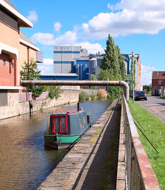
Image: © David Hallam-Jones Taken: 8 Sep 2016
With the former straddle warehouse (a.k.a. "Pickford's Depository") behind the photographer, this is the view towards a T junction of Canal Road with Kilton Road. The Albion Mill, parts of which date from 1906, can be seen ahead on the opposite bank. The flour mill, which has its main (front) entrance on Eastgate, is currently owned by Whitworth Bros. of Wellingborough. The Chesterfield Canal originally covered a distance of 46 miles (or 74 km) from the River Trent at West Stockwith, Nottinghamshire to Chesterfield, Derbyshire. Currently 31.6 miles (or 50.9 km) of the canal is navigable in two unjoined stretches.
Images are licensed for reuse under creativecommons.org/licenses/by-sa/2.0
Image Location
Latitude
53.306865
Longitude
-1.121291