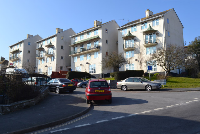
Regency-flavour local authority flats, Gloucester Road, Teignmouth
Introduction
The photograph on this page of Regency-flavour local authority flats, Gloucester Road, Teignmouth by Robin Stott as part of the Geograph project.
The Geograph project started in 2005 with the aim of publishing, organising and preserving representative images for every square kilometre of Great Britain, Ireland and the Isle of Man.
There are currently over 7.5m images from over 14,400 individuals and you can help contribute to the project by visiting https://www.geograph.org.uk

Image: © Robin Stott Taken: 15 Mar 2016
These flats, and the accompanying road realignments, were completed between 1963 and 1977, according to old OS maps. The balconies echo features of the many Regency villas in the town. The view is across the southern end of Exeter Road, which was realigned away from narrow Exeter Street in this period. Bitton Street and other roads were widened to become the present A379 through Teignmouth. It was a radical change to the town's fabric that appears to have been planned in the post-war years: the site of these flats, and their neighbours on Bitton Park Road, was shown cleared on a map of 1955, with similar flats in place on the south side of the road. The reason was perhaps three-fold: to improve the housing stock, to improve lorry access to the port, and to remove coastal holiday traffic from the narrow streets of the town centre.

