Highbridge from the air
Introduction
The photograph on this page of Highbridge from the air by Derek Harper as part of the Geograph project.
The Geograph project started in 2005 with the aim of publishing, organising and preserving representative images for every square kilometre of Great Britain, Ireland and the Isle of Man.

There are currently over 7.5m images from over 14,400 individuals and you can help contribute to the project by visiting https://www.geograph.org.uk
Highbridge from the air
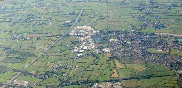
Image: © Derek Harper Taken: 8 Sep 2016
From an aircraft above Brent Knoll. The M5 (left) and the main railway line converge. Junction 22 on the motorway is at bottom left. The white of the business units on the Isleport Business Park contrasts with the rest of the town across the railway.
Images are licensed for reuse under creativecommons.org/licenses/by-sa/2.0
Image Location
Latitude
51.220864
Longitude
-2.970779