Defending Dorset in 1940: Blandford anti-tank island - loopholed wall (4)
Introduction
The photograph on this page of Defending Dorset in 1940: Blandford anti-tank island - loopholed wall (4) by Mike Searle as part of the Geograph project.
The Geograph project started in 2005 with the aim of publishing, organising and preserving representative images for every square kilometre of Great Britain, Ireland and the Isle of Man.

There are currently over 7.5m images from over 14,400 individuals and you can help contribute to the project by visiting https://www.geograph.org.uk
Defending Dorset in 1940: Blandford anti-tank island - loopholed wall (4)
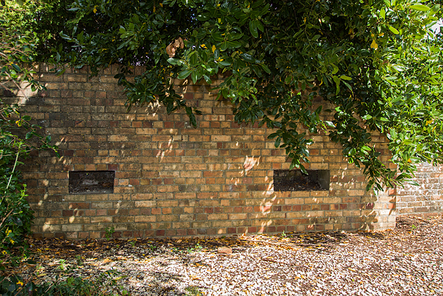
Image: © Mike Searle Taken: 8 Sep 2016
- Loopholed wall: DoB ID: S0003144 In a far corner of the Crown Hotel car park are two loopholes set into the boundary wall. It is thought that these probably served no purpose other than to create the illusion they were real. They were dummy loopholes designed to draw fire from the enemy. Image
Images are licensed for reuse under creativecommons.org/licenses/by-sa/2.0
Image Location
Latitude
50.855643
Longitude
-2.16773