Former Methodist chapel, Great Fencote
Introduction
The photograph on this page of Former Methodist chapel, Great Fencote by Gordon Hatton as part of the Geograph project.
The Geograph project started in 2005 with the aim of publishing, organising and preserving representative images for every square kilometre of Great Britain, Ireland and the Isle of Man.

There are currently over 7.5m images from over 14,400 individuals and you can help contribute to the project by visiting https://www.geograph.org.uk
Former Methodist chapel, Great Fencote
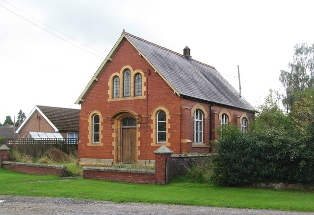
Image: © Gordon Hatton Taken: 4 Sep 2016
I'm guessing that the chapel is no longer used as the state of the grass around the building and the lack of any noticeboard would suggest this is the case. Also no signs as yet of this being adapted into a dwelling. The date of the building appears to be early 20thC as it appears on the 1920 OS map, but not on maps previous to this date, although there is another chapel shown on older maps less than 100m distant.
Images are licensed for reuse under creativecommons.org/licenses/by-sa/2.0
Image Location
Latitude
54.337713
Longitude
-1.564712