Zero Degrees
Introduction
The photograph on this page of Zero Degrees by Glyn Baker as part of the Geograph project.
The Geograph project started in 2005 with the aim of publishing, organising and preserving representative images for every square kilometre of Great Britain, Ireland and the Isle of Man.

There are currently over 7.5m images from over 14,400 individuals and you can help contribute to the project by visiting https://www.geograph.org.uk
Zero Degrees
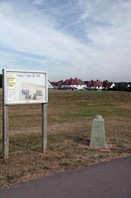
Image: © Glyn Baker Taken: 31 Aug 2016
The stone marks the Greenwich Meridian as it passes through Coney Hall Park. A few months ago I heard a report on the radio that the people who run the GPS system claimed that the meridian line marker at the Royal Observatory was 100m out of place. How a totally arbitrary line on the ground chosen by the Royal observatory 300 years ago can be in the wrong place beats me! Where the line was drawn is where it is, and always will be until international agreement decides to move the Image to somewhere else.
Images are licensed for reuse under creativecommons.org/licenses/by-sa/2.0
Image Location
Latitude
51.367278
Longitude
-0.00162