Power lines heading to or from University Hospital, Walsgrave, Coventry
Introduction
The photograph on this page of Power lines heading to or from University Hospital, Walsgrave, Coventry by Robin Stott as part of the Geograph project.
The Geograph project started in 2005 with the aim of publishing, organising and preserving representative images for every square kilometre of Great Britain, Ireland and the Isle of Man.

There are currently over 7.5m images from over 14,400 individuals and you can help contribute to the project by visiting https://www.geograph.org.uk
Power lines heading to or from University Hospital, Walsgrave, Coventry
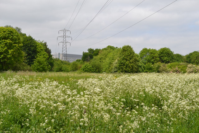
Image: © Robin Stott Taken: 2 Jun 2016
This telephoto view is from the floodmeadow east of Abbotsbury Close, where the Sowe Valley path follows the river. Cow Parsley is in full bloom; hawthorn is just past. The power lines emerge from (or go) underground south of the huge hospital and appear to go underground (or emerge) to the north of it. Whether this actually is the hospital's supply is not known. Satellite images show nothing that looks like a substation. Usage must be colossal.
Images are licensed for reuse under creativecommons.org/licenses/by-sa/2.0
Image Location
Latitude
52.417557
Longitude
-1.437553