Woolton Hill Road
Introduction
The photograph on this page of Woolton Hill Road by Sue Adair as part of the Geograph project.
The Geograph project started in 2005 with the aim of publishing, organising and preserving representative images for every square kilometre of Great Britain, Ireland and the Isle of Man.

There are currently over 7.5m images from over 14,400 individuals and you can help contribute to the project by visiting https://www.geograph.org.uk
Woolton Hill Road
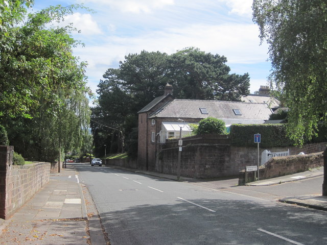
Image: © Sue Adair Taken: 26 Aug 2016
Woolton Hill Road was described in The Enclosure Act of 1805 as Red Brow, "40 ft wide, where hitherto the cows and sheep of Gateacre had drifted to their common pastures". Woolton Hill would have been common land of rough scrubland and red sandstone outcrops prior to becoming a favoured location for wealthy merchants to build grand country mansions. The house to the right is simply named "The Cottage" on early maps and is linked to the grand house Baycliff built in 1869-71 (now the residence of Liverpool's Anglican bishops known as Bishop's Lodge).
Images are licensed for reuse under creativecommons.org/licenses/by-sa/2.0
Image Location
Latitude
53.382257
Longitude
-2.869358