Braeholm House
Introduction
The photograph on this page of Braeholm House by Lairich Rig as part of the Geograph project.
The Geograph project started in 2005 with the aim of publishing, organising and preserving representative images for every square kilometre of Great Britain, Ireland and the Isle of Man.

There are currently over 7.5m images from over 14,400 individuals and you can help contribute to the project by visiting https://www.geograph.org.uk
Braeholm House
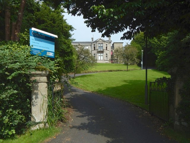
Image: © Lairich Rig Taken: 17 Aug 2016
The view is from Image Braeholm had closed at the end of July 2016, less than three weeks before this picture was taken. The B-listed building had been employed as, amongst other things, a retirement home, and (what I most associate with it) a maternity hospital. (Under the name Braeholm, the sign says "serving the naval service since 1876", which might be a little confusing; at least, it did not sit well with my own knowledge of the building's previous use. However, that tagline does not apply to the building itself, but refers instead to the year in which the charity Aggie Weston's was founded; that organisation had been operating Braeholm in recent decades.) The building dates from about 1860. William Leiper (listed in the tags for this picture) was the architect for changes made in 1887, when a drawing room bay was added.
Images are licensed for reuse under creativecommons.org/licenses/by-sa/2.0
Image Location
Latitude
56.005092
Longitude
-4.717099