The Tully Road (Killead bypass) (August 2016)
Introduction
The photograph on this page of The Tully Road (Killead bypass) (August 2016) by Albert Bridge as part of the Geograph project.
The Geograph project started in 2005 with the aim of publishing, organising and preserving representative images for every square kilometre of Great Britain, Ireland and the Isle of Man.

There are currently over 7.5m images from over 14,400 individuals and you can help contribute to the project by visiting https://www.geograph.org.uk
The Tully Road (Killead bypass) (August 2016)
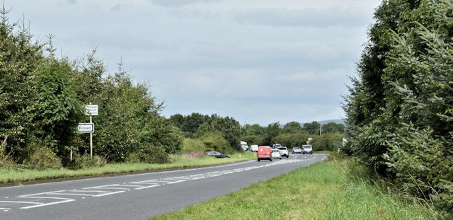
Image: © Albert Bridge Taken: 27 Aug 2016
There have been many changes, over the years, to the roads at Ballyrobin, Killead, arising from The Troubles, the closure of many minor roads around the airport Image, the growth of road traffic, the expansion of Belfast International and the existence of RAF. (now Joint Helicopter Command Flying Station), Aldergrove). The Tully Road, seen here from the corner of the Carmavy Road Image, forms part of the road from Moira Image to Ballyrobin roundabout Image, the airport, Larne harbour, Coleraine, the north coast and Londonderry. It opened, in 1994, on a completely new alignment bypassing Killead (to the east/north east) and some local minor roads. To appreciate the difference compare today’s OS map with the old one-inch sheet 6. Drennan’s Road Image, one of the minor roads bypassed, is marked by the emerging black car to the left of the mail van.
Images are licensed for reuse under creativecommons.org/licenses/by-sa/2.0
Image Location
Latitude
54.66402
Longitude
-6.17793