Dawlish Water
Introduction
The photograph on this page of Dawlish Water by Richard Dorrell as part of the Geograph project.
The Geograph project started in 2005 with the aim of publishing, organising and preserving representative images for every square kilometre of Great Britain, Ireland and the Isle of Man.

There are currently over 7.5m images from over 14,400 individuals and you can help contribute to the project by visiting https://www.geograph.org.uk
Dawlish Water
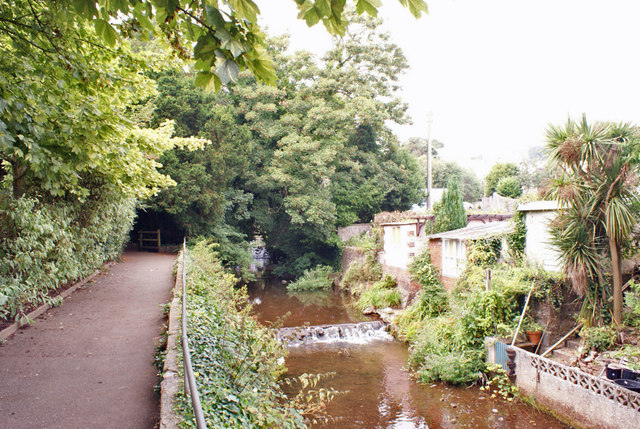
Image: © Richard Dorrell Taken: 18 Aug 2016
The shallow river is here flowing out of Manor Gardens. It goes on to flow through the centre of the town. The buildings on the right are sheds at the rear of residential properties in Brook Street.
Images are licensed for reuse under creativecommons.org/licenses/by-sa/2.0
Image Location


Leaflet Map data © OpenStreetMap
Latitude
50.58069
Longitude
-3.474791