Cafe, Woodberry Wetlands
Introduction
The photograph on this page of Cafe, Woodberry Wetlands by Jim Osley as part of the Geograph project.
The Geograph project started in 2005 with the aim of publishing, organising and preserving representative images for every square kilometre of Great Britain, Ireland and the Isle of Man.

There are currently over 7.5m images from over 14,400 individuals and you can help contribute to the project by visiting https://www.geograph.org.uk
Cafe, Woodberry Wetlands
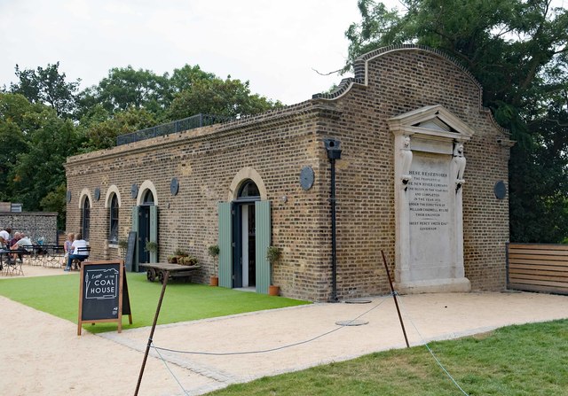
Image: © Jim Osley Taken: 18 Aug 2016
The cafe occupies a Grade II listed 19th century former gas house, Woodberry Wetlands. Description at this https://historicengland.org.uk/listing/the-list/list-entry/1265631. A brief history of the Gas House may be found at this http://idox.hackney.gov.uk/WAM/doc/Other-416698.pdf?extension=.pdf&id=416698&location=VOLUME1&contentType=&pageCount=1.
Images are licensed for reuse under creativecommons.org/licenses/by-sa/2.0
Image Location
Latitude
51.569919
Longitude
-0.087898